How Drone Surveys are Transforming Solar Farm Efficiency

Nathan Sheets • January 21, 2025

The Role of Drones in Solar Farm Management

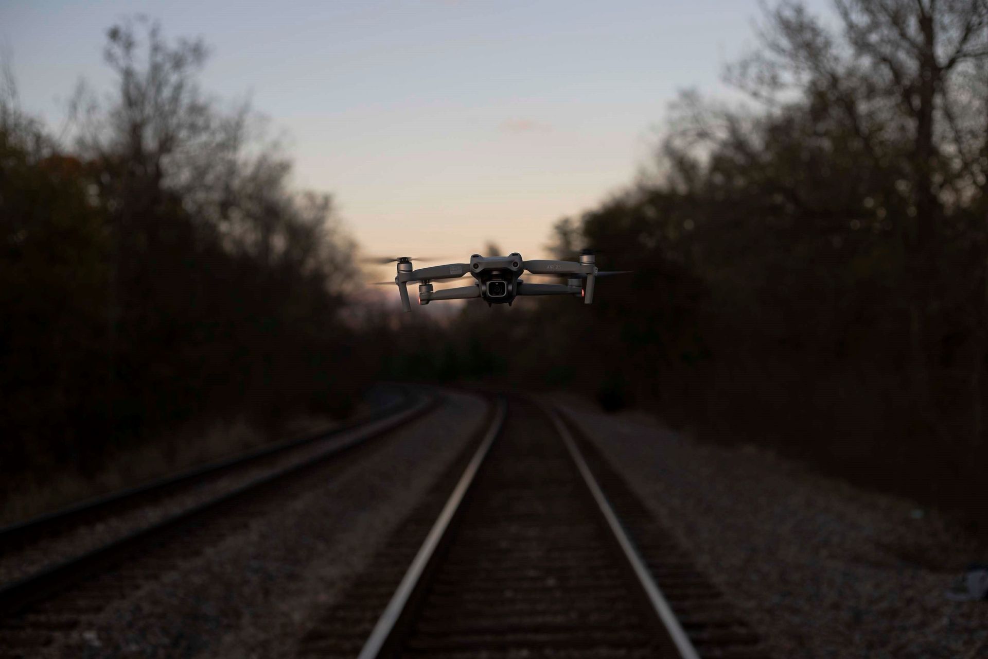
Solar farms are an essential part of the transition to renewable energy, but managing and maintaining them can be challenging. Drones are transforming the way solar farms operate by streamlining inspections, improving efficiency, and reducing costs. According to a recent industry report, drones can reduce solar farm inspection times by up to 85%, making them a critical tool for modern solar farm management. Equipped with advanced imaging technology, drones offer unparalleled insights into solar farm performance, helping operators maximize energy production and minimize downtime.


Benefits of Drone Surveys for Solar Farms


1. Faster Inspections


Traditional inspection methods for solar farms can take days, requiring personnel to manually examine rows of panels. Drone surveys significantly reduce inspection time, covering large areas in hours. This speed allows for more frequent assessments, ensuring potential issues are identified and addressed promptly.


2. Enhanced Accuracy with Thermal Imaging


Drones equipped with thermal cameras can detect subtle temperature variations in solar panels. These variations often indicate issues such as faulty wiring, hotspots, or defective cells. By pinpointing problem areas with precision, drone surveys eliminate guesswork and enable targeted maintenance.


3. Cost-Effective Maintenance


Manual inspections often require extensive labor and specialized equipment. Drone surveys provide a more cost-effective solution by reducing the need for manpower and equipment rentals. Additionally, early detection of problems helps prevent costly repairs or replacements.


4. Safety Improvements


Inspecting solar farms manually can be hazardous, especially in large installations with elevated panels. Drones eliminate the need for physical access to potentially dangerous areas, enhancing safety for inspection teams.


Key Applications of Drone Technology in Solar Farms


Thermal Imaging for Fault Detection


Using thermal imaging, drones can identify underperforming panels, shading issues, and electrical faults. These insights help operators maintain peak efficiency and extend the lifespan of their solar arrays.


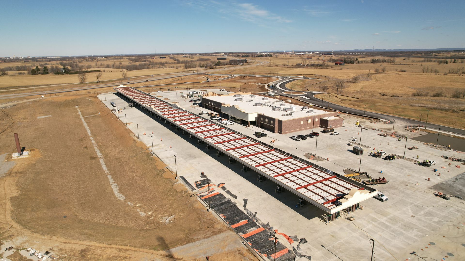
Site Mapping and Planning


High-resolution aerial imagery captured by drones is invaluable during the planning and construction phases of solar farms. Detailed maps ensure optimal panel placement and efficient land use.


Ongoing Performance Monitoring


Routine drone surveys enable operators to monitor the health of their solar farms continuously. This proactive approach ensures that minor issues are addressed before they escalate, maintaining consistent energy output.


Real-World Impact: Drone Surveys in Action


One case study involves a 50-acre solar farm that implemented drone inspections to replace traditional methods. The drones completed a full survey in under three hours, identifying several defective panels that were previously overlooked. By addressing these issues early, the farm increased its energy production by 8% and saved thousands of dollars in repair costs.


Conclusion: The Future of Solar Farm Efficiency


Drone surveys are no longer a luxury but a necessity for solar farm operators looking to stay competitive. By enhancing efficiency, reducing costs, and improving safety, drones are paving the way for a more sustainable and reliable solar energy future.


Ready to transform your solar farm operations? Contact us today to learn more about our drone services for solar farms.


By Nathan Sheets June 25, 2024
✈️ With over 10 years in aviation, including 400+ fixed wing flight hours and professional flight degrees, I'm sharing insights on reducing pilot mental workload in drone operations. From automated flight paths to leveraging visual observers, learn how to optimize focus and efficiency in complex environments. Perfect for peers, new drone pilots, and companies looking to optimize aerial missions and training. Let me know some of your tips and best practices!
By Nathan Sheets October 4, 2023
In the ever-evolving world of aviation, the integration of unmanned aircraft systems (UAS) or drones has become a prominent topic of discussion. One crucial aspect of this integration is the Federal Aviation Administration's (FAA) initiative regarding Remote Identification (Remote ID) of drones. Remote ID is a system designed to enhance safety and security by providing identification and location information for drones while they are in flight. Some see it as a neccessary step to implementation of UAS into the National Airspace System (NAS). Others see it as a massive step backwards for drone flying across the country. In this blog post, we'll delve into the details of the FAA's Remote ID program, the reasons behind its delay, and the potential consequences for contractors who are unaware of the current landscape. What is Remote ID and Its Importance? Remote ID is a system that allows the real-time tracking and identification of drones while they're in operation. Its primary purpose is to address safety and security concerns associated with the increasing use of drones in various airspace. By providing essential information such as the drone's location, altitude, speed, and the location of its operator, authorities can ensure responsible drone operation and mitigate potential risks to other airspace users and the public. The Delay of Remote ID Implementation Originally, the FAA aimed to implement the Remote ID rule by late 2020, envisioning a step towards safer drone integration into the national airspace. However, the implementation was delayed, primarily due to the complexity of establishing a robust, efficient, and comprehensive Remote ID system. The most recent delay happened in September of 2023 when the FAA received thousands of notifications citing Remote ID module backlog and supply chain issues as the reason for not being in compliance. In response to these requests, the FAA pushed the enforcement of RID until March 16, 2023. At that time, all operators who are required to be broadcasting their RID information will be required to do so or face penalties. Fines and Legal Implications for Contractors As part of the FAA's efforts to promote safe and responsible drone operations, penalties and fines are imposed on individuals and entities violating regulatory requirements. This includes fines for flying without proper authorization or licensing. Moreover, contractors who hire unlicensed drone pilots may also face significant fines for non-compliance with FAA regulations. This is important for entities scaling UAS operations within their companies. If those companies are not aware or don’t know what they are doing, they can find themselves in very hot water. The fines can vary in severity based on the nature and frequency of the violation, emphasizing the importance of adhering to licensing and operational guidelines set forth by the FAA. Conclusion Remote ID is a crucial tool for enhancing safety and security in the rapidly evolving world of drone technology. While its implementation faced delays, the FAA's commitment to refining the system is a testament to its dedication to safe and responsible drone integration. For contractors and operators in the drone industry, compliance with FAA regulations and the proper licensing of pilots is essential to avoid legal repercussions and contribute to a safe and responsible drone ecosystem.  For the latest updates on the FAA's Remote ID and other drone-related regulations, stay tuned to our blog and the FAA’s website. We're dedicated to keeping you informed about the ever-changing landscape of drone technology and its impact on aviation.
Share by: